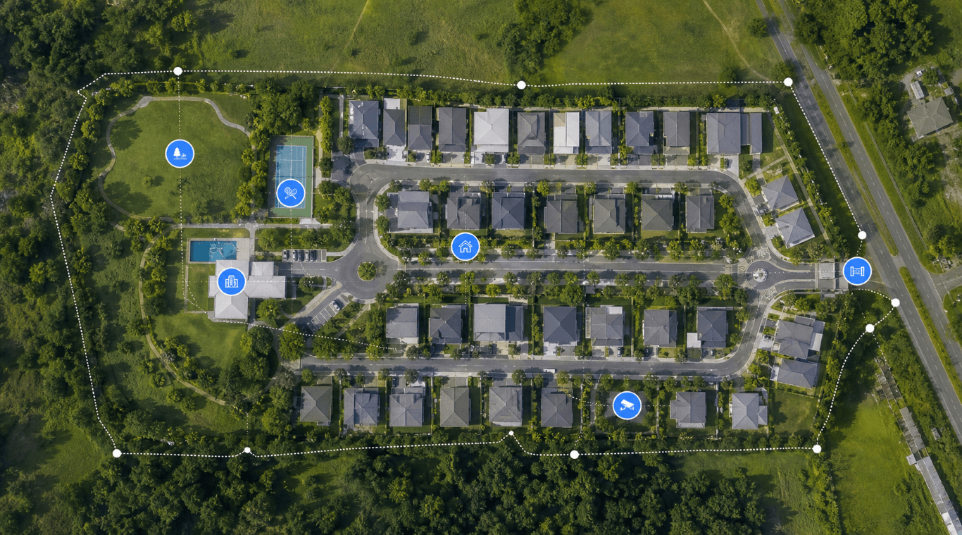
Aerial Mapping Services

See the whole village clearly before planning the next improvement.

VillageTech uses aerial mapping to help communities document roads, facilities, drainage concerns, assets, perimeter areas, lots, expansion areas, and security planning needs with a clearer view than ground photos alone can provide.

Site documentation Planning support Asset visibility Security coverage
Aerial mapping view of a residential community
Community map intelligence Aerial context helps boards and managers make better planning decisions.

THE FACTS

The Problem

Village decisions suffer when everyone is looking at different evidence.

Road repairs, drainage issues, security blind spots, facility upgrades, perimeter concerns, and project proposals are harder to discuss with scattered photos, vague descriptions, or outdated maps.

The Solution

Aerial mapping gives the board a shared visual reference.

VillageTech provides aerial capture and map-oriented deliverables that help officers, managers, and committees review current conditions, plan improvements, document assets, and communicate community projects.

The VillageTech Advantage

VillageTech maps with operations and integration in mind.

We are not just capturing pretty aerial images. We use mapping to support gate planning, CCTV placement, guard routes, asset documentation, facility planning, and future HOMES-linked location records.

Designed for community operations

Useful for board planning, operations, facilities, and security design.

Community overview maps

Create visual references for roads, blocks, facilities, open spaces, perimeter areas, and key assets.

Project planning support

Use aerial context to discuss road works, drainage improvements, landscaping, security posts, and facility upgrades.

CCTV and patrol planning

Identify coverage gaps, route logic, checkpoint locations, and places that need better visibility.

Asset documentation

Document amenities, structures, vacant areas, common property, and visible infrastructure conditions.

Before-and-after records

Capture visual baselines before major works, improvements, or remediation projects.

Presentation-ready visuals

Give boards and committees clearer visuals for meetings, proposals, and resident communication.

Next step

Map your community with a purpose.

We can capture aerial references and turn them into planning material for board decisions, security design, and VillageTech system rollout.

Related solutions